Just before midnight on Thursday, Sept. 26, Hurricane Helene slammed into Florida’s Big Bend area at the top the panhandle. The Category 4 storm packed winds that topped 225 km per hour, caused storm surges taller than a bungalow, and mulched whole neighbourhoods in a matter of minutes. From there it tracked north toward Georgia and the Carolinas, and on into Tennessee, where torrential rainfall overran the Nolichucky River and stranded Unicoi County Hospital patients and staff, who were rescued by helicopter and boat. Not quite two weeks later, Hurricane Milton followed in Helene’s path; damages from both storms together are expected to top $55 billion USD.
None of this does justice to the heartbreak and devastation experienced by communities and families and flesh-and-blood people affected by the storm, or the rebuilding they now face — all of this with weeks left to go in an Atlantic hurricane season the National Oceanic and Atmospheric Administration forecast back in May would be above normal. That forecast has held true.
It’s impossible to ignore the fast-moving, high-drama disasters of storms like these. But slower, quieter dramas playing out on coastlines around the world may prove just as deadly.
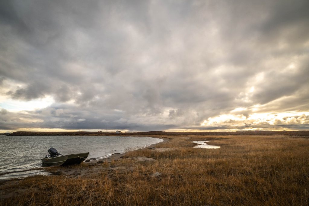
I was nearly as far away as a person can be in North America when NOAA first posted serious warnings about Helene. I was out doing interviews for a book about how shoreline erosion is affecting coastal communities around the world, and was just wrapping a trip to Tuktoyaktuk, Northwest Territories. Tuktoyaktuk is a place of legends. About 900 people live here on the edge of the Beaufort Sea. At 69 degrees north, it’s well past the treeline, but the beaches are piled with masses of driftwood deposited by the mighty Mackenzie, Canada’s longest river, running in from the south. It sits at the western gateway to the Northwest Passage that so many died seeking. It’s the heart of the Inuvialuit Settlement Region, formally recognized by the federal government 40 years ago in what became Canada’s first comprehensive land claim agreement north of 60.
Will you stand with us?
Your support is essential to making journalism like this possible.
I’d wanted to visit as long as I could remember, and now coastal erosion had brought me here. Over the past year I’d travelled to Newfoundland and Labrador’s Channel-Port aux Basques on the first anniversary of Hurricane Fiona when so much of Water Street East had been swept out to sea; I’d travelled to the Magdalen Islands, Boston and the Bay of Biscay and Cornwall. Sadly, with current trends in global warming and sea level rise you could spin the globe and find stories to tell about coastal erosion almost anywhere. But the situation for Tuktoyaktuk seemed particularly precarious, and I wanted to talk to people who were living it.
In some ways, Tuktoyaktuk is typical for other small northern communities I know. Trucks and quads and snowmobiles sit packed into driveways. The houses are small and unfussy. It has a couple of general stores, and a lot of metal cladding. It’s the kind of place where people wonder where you’re going if they see you turn left at the school instead of right, like you always do this time of day. I claim this with authority because I grew up in a place even smaller.
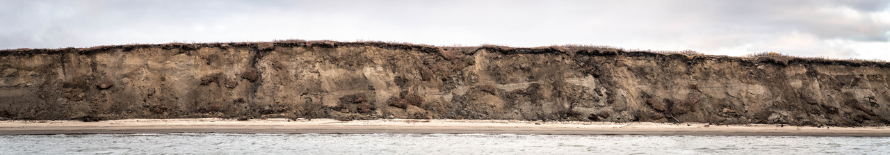
But what’s different about Tuktoyaktuk compared to what I’ve seen elsewhere is just how vulnerable its residents are to coastal flooding. Tuktoyaktuk sits right on the ocean. It doesn’t get hurricanes the likes of Helene, but nudging out into the Arctic Ocean as it does, it sees its share of wind, with storm surges of up to two and three metres. And unlike low-lying coastal communities I know and love in Newfoundland and Labrador, which are richly endowed with bedrock, Tuktoyaktuk sits on a low, narrow peninsula comprised of largely unconsolidated material frozen into permafrost. Over the past 50 years, the Arctic has warmed nearly four times faster than the global average, and the permafrost is thawing. This is compounding the problems Tuktoyaktuk residents are already seeing from rising sea levels and big storm surges.
Look at the conundrum Ryan Yakeleya’s family faces, for example. You’ll find his house on Beaufort Road, out near the point, just shy of the Arctic Ocean sign that so many visitors come to take a picture of. The Inuvialuktun name for this place is Nuuvuraluuk. Yakaleya’s house is the last one standing on the western side of this stretch of land. In 2020, the hamlet moved the three homes of his neighbours about nine kilometres to the south, to a place called Reindeer Point. Sitting at his kitchen table, just a few metres from the water’s edge, Yakaleya told me that the hamlet had offered to move his house, too, but he declined. He didn’t think things were quite that bad yet, and he had the means to move his house himself, if and when the time came.
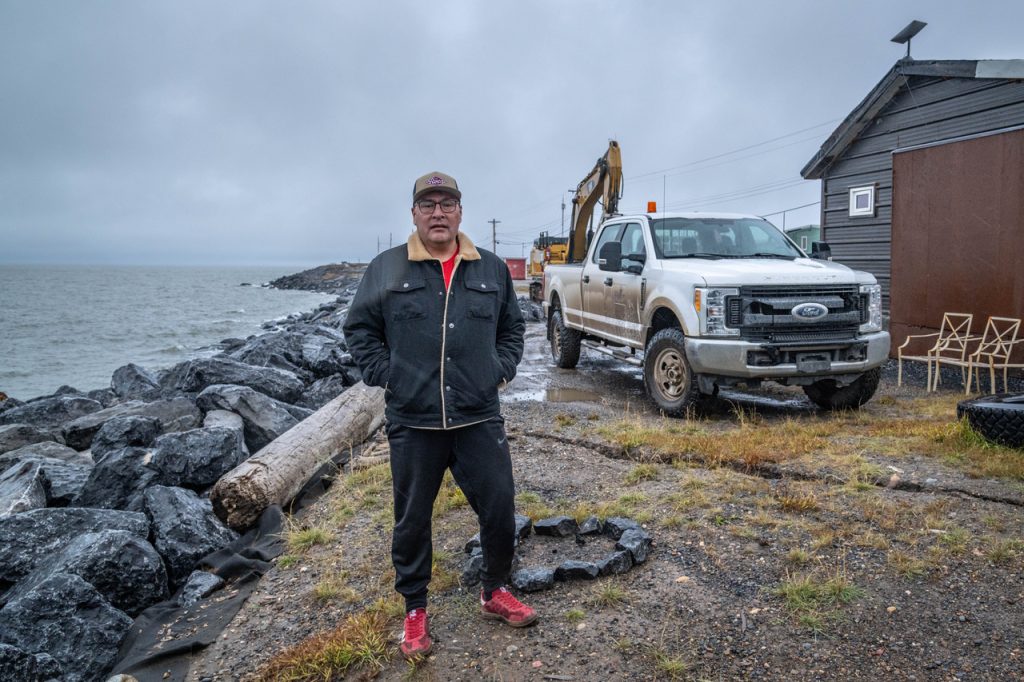
This spring, in an Infrastructure Canada-funded erosion mitigation program, dozens of truckloads of boulders were hauled 150 km over the slick, rutty highway from Inuvik and deposited along the coastline in front of his house. He’d hoped that would shore things up. But armour stone does nothing to protect permafrost from thawing, and two weeks before I visited, he noticed a long crack opening up just in front of his grandkids’ trampoline.
For Yakaleya, the time is still not right to move, but he knows he’ll probably have to one day. The hamlet is working on a relocation plan, and in twenty or thirty years, Tuktoyaktuk may become the first community in Canada to move because of climate change. Towns in Alaska such as Newtok have already begun. Already there is a line in the sand at the Tuktoyaktuk fire hall: beyond this point, the hamlet permits no new buildings because of proximity to the eroding coastline.
Most people I spoke to in Tuktoyaktuk see community relocation as inevitable. Mayor Erwin Elias did not hide his frustration when, sitting across from him on the other side of a map of the flood zones, I asked about trying to coordinate such an undertaking. I was trying to imagine having to move not only houses, but public buildings, old fuel tanks, broken equipment, the dump. And what about the cemetery? All this in a place where equipment and supplies and labour are limited, and where the weather can be punishing.
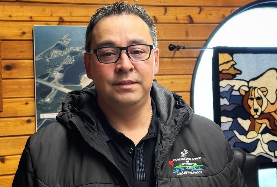
“Someone from one department comes,” Elias said, “and then another one. Why aren’t they talking to each other?”
I left Tuktoyaktuk and travelled the long highway back to Inuvik and flew on to Calgary. The next day, back at work, person after person asked me if I’d seen what was happening in Florida. I looked up the images and watched in horror with all the rest.
Seeing all of it on the heels of my visit to Tuktoyaktuk, and so many places in Newfoundland and Labrador, and elsewhere, it occurred to me that storms like Helene and Milton strike with such apparent fury and precision it’s hard not to see them as driven by some kind of malevolent intention. Of course they’re just symptoms of a deeper disease: global warming, sea level rise, human vulnerabilities of all kinds. But they’re fast disasters, and they get our attention — at least for a moment.
My travels through coastal communities around the world are showing me that slow disasters in quieter places carry a special type of menace: the daily threat of homes and people being washed to sea, the existential loss of ancestors and material history, an unpredictable crack in front of your grandkids’ trampoline. Just the other day, folks in Tuktoyaktuk took to Facebook Live to show just how high the water was in town. Coastal erosion is something they walk beside every day. It’s not a problem for 20 years from now, when relocation might begin. It’s problem for every storm surge and for every high tide.
Back in Tuktoyaktuk, faced with a frustrated mayor, I told Elias I hoped that collecting stories like his in a book might help stir some action.
“Don’t wait for a book,” he said. “Say it now.”

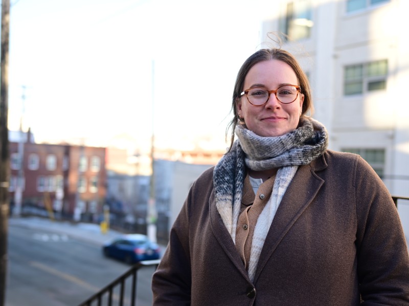
Author

Related Articles
Meet two of St. John’s local heroes of transportation
Can community members help make walking safer in winter? Megan Clemens and Myles Russell think so

International Women’s Day is not a celebration
How do we build a fighting feminist movement?
The PC’s subtle Throne Speech caveat
Wakeham government quietly places an asterisk next to its promise, ‘For all of us’